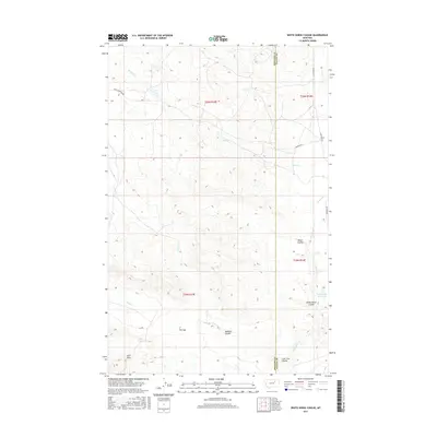
2017 Map of White Horse Coulee
USGS Topo · Published 2017About this map
Larb Hills anchor the southwestern corner of this high-plains landscape in Valley and Phillips Counties. The terrain is defined by an intricate network of drainage channels, or coulees, including the prominent White Horse Coulee and Black Coulee. These features represent the characteristic erosional topography of the Montana badlands, where water management is critical for ranching, evidenced by the presence of Bearcracks Reservoir. Local navigation is facilitated by rural routes such as Triple Crossing Rd and Content Rd, which traverse the open range between drainage systems like Larb Cr and Sage Cr. A notable geological or surveyor's reference known as The Sag sits near Badland Coulee, providing a specific landmark for those studying the physical history of the region. The map captures the quiet, sparsely populated nature of the eastern Montana prairie at the start of the twenty-first century.
Find a feature on this map
22 named features on this map. Tap any name to fly to it.
Don’t see what you’re looking for? This feature index may not catch every label — zoom into the map to look around manually.
Map Details
Editions of this 2017 White Horse Coulee Map
This is the sole edition of this map. No revisions or reprints were ever made.
Other maps of this area

1954 · Jordan
USGS Topo · 1:250,000

1954 · Glasgow
USGS Topo · 1:250,000

1956 · Jordan
USGS Topo · 1:250,000

1957 · Glasgow
USGS Topo · 1:250,000

1958 · Glasgow
USGS Topo · 1:250,000

1958 · Jordan
USGS Topo · 1:250,000

1964 · Jordan
USGS Topo · 1:250,000

1965 · Coal Mine Hill
USGS Topo · 1:24,000

1965 · Buckley Lake
USGS Topo · 1:24,000

1973 · Niles Coulee
USGS Topo · 1:24,000