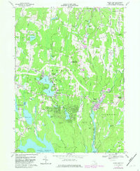
1967 Map of White Lake
USGS Topo · Published 1982About this map
White Lake and the neighboring community of Kauneonga Lake form the social heart of this Sullivan County landscape, a region deeply defined by its summer recreation and resort character during the mid-20th century. The concentration of settlements like Smallwood and Mongaup Valley suggests a pattern of seasonal growth around the area's numerous water bodies, including the significant Swinging Bridge Reservoir and Toronto Reservoir. Local family history and community life are anchored by landmarks such as the Cornelius Duggan School, St Anns Church, and several burial grounds including Temple Beth El Cemetery and Bethel Evergreen Cemetery. The presence of the Sullivan County International Airport and the Lake Superior State Park highlights the area's role as a regional hub for both travel and public leisure during this era.
Find a feature on this map
97 named features on this map. Tap any name to fly to it.
Don’t see what you’re looking for? This feature index may not catch every label — zoom into the map to look around manually.
Map Details
Editions of this 1967 White Lake Map
2 editions found
Other maps of this area

1909 · Monticello
USGS Topo · 1:62,500

1910 · Neversink
USGS Topo · 1:62,500

1911 · Monticello
USGS Topo · 1:62,500

1921 · Livingston Manor
USGS Topo · 1:62,500

1922 · White Lake
USGS Topo · 1:62,500

1923 · Livingston Manor
USGS Topo · 1:62,500

1942 · White Lake
USGS Topo · 1:62,500

1942 · Neversink
USGS Topo · 1:62,500

1943 · White Lake
USGS Topo · 1:62,500

1943 · Monticello
USGS Topo · 1:62,500