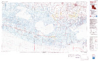
1983 Map of White Lake
USGS Topo · Published 1983About this map
White Lake dominates this coastal landscape in the early 1980s, serving as a focal point for the complex intersection of Louisiana's marshlands and commercial waterways. This map details a region defined by its cheniers—coastal ridges such as Grand Chenier Ridge and Pecan Island Ridge—which provided the high ground necessary for settlements like Grand Chenier and Pecan Island amidst the wetlands. The transition from agricultural prairie near Kaplan and Abbeville to the brackish marshes of the Rockefeller State Wildlife Refuge and Game Preserve is clearly visible.
Find a feature on this map
93 named features on this map. Tap any name to fly to it.
Don’t see what you’re looking for? This feature index may not catch every label — zoom into the map to look around manually.
Map Details
Editions of this 1983 White Lake Map
2 editions found
Other maps of this area

1932 · Abbeville SW
USGS Topo · 1:31,680

1932 · Constance Bayou NE
USGS Topo · 1:31,680

1932 · Abbeville SE
USGS Topo · 1:31,680

1932 · Abbeville NE
USGS Topo · 1:31,680

1932 · Pecan Island SE
USGS Topo · 1:31,680

1932 · Constance Bayou SW
USGS Topo · 1:31,680

1932 · Abbeville NW
USGS Topo · 1:31,680

1932 · Pecan Island SW
USGS Topo · 1:31,680

1932 · Lake Charles SE
USGS Topo · 1:31,680

1932 · Constance Bayou SE
USGS Topo · 1:31,680