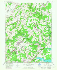
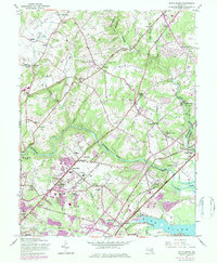
1951 Map of White Marsh
USGS Topo · Published 1967About this map
Gunpowder Falls winds through a landscape of evolving rural communities and rising infrastructure in this mid-century survey of northeastern Baltimore County. The map captures the significant role of early transportation, showing the Pennsylvania and Maryland Railroad serving small stations like Baldwin Station and Long Green Station, while the Baltimore and Ohio Railroad traverses the southeastern corner near White Marsh Station. These rail corridors are contrasted by the growth of major roadways such as Pulaski Highway and Bel Air Road, reflecting the area's transition towards modern connectivity.
Find a feature on this map
60 named features on this map. Tap any name to fly to it.
Don’t see what you’re looking for? This feature index may not catch every label — zoom into the map to look around manually.
Map Details
Editions of this 1951 White Marsh Map
6 editions found

Other maps of this area

1893 · Gunpowder
USGS Topo · 1:62,500

1894 · Baltimore
USGS Topo · 1:62,500

1898 · Tolchester
USGS Topo · 1:125,000

1899 · Baltimore
USGS Topo · 1:62,500

1900 · Parkton
USGS Topo · 1:62,500

1901 · Belair
USGS Topo · 1:62,500

1901 · Gunpowder
USGS Topo · 1:62,500

1902 · Parkton
USGS Topo · 1:62,500

1903 · Tolchester
USGS Topo · 1:125,000

1904 · Baltimore
USGS Topo · 1:62,500