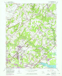
1951 Map of White Marsh
USGS Topo · Published 1975About this map
Gunpowder Falls and its tributary, Little Gunpowder Falls, carve a deep path through this Maryland landscape, defining the boundary between Baltimore and Harford counties. The mid-century map shows a region in transition, where established crossroads like Kingsville and Jerusalem sit amidst an expanding suburban footprint near Perry Hall. Purple revision overlays from the late 1960s and early 1970s trace the growth of new residential streets and industrial footprints, including several greenhouses and a drive-in theater near the Whitemarsh Run.
Find a feature on this map
57 named features on this map. Tap any name to fly to it.
Don’t see what you’re looking for? This feature index may not catch every label — zoom into the map to look around manually.
Map Details
Editions of this 1951 White Marsh Map
6 editions found


Other maps of this area

1893 · Gunpowder
USGS Topo · 1:62,500

1894 · Baltimore
USGS Topo · 1:62,500

1898 · Tolchester
USGS Topo · 1:125,000

1899 · Baltimore
USGS Topo · 1:62,500

1900 · Parkton
USGS Topo · 1:62,500

1901 · Belair
USGS Topo · 1:62,500

1901 · Gunpowder
USGS Topo · 1:62,500

1902 · Parkton
USGS Topo · 1:62,500

1903 · Tolchester
USGS Topo · 1:125,000

1904 · Baltimore
USGS Topo · 1:62,500