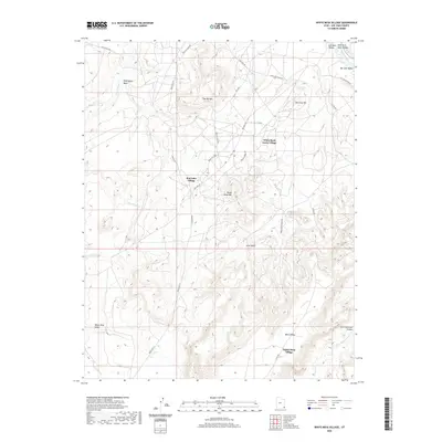
2020 Map of White Mesa Village
USGS Topo · Published 2020About this map
White Mesa Village and Red Lake Village anchor this high-desert landscape in San Juan County, where tribal routes and modern roads intersect. The terrain is defined by dramatic elevations such as Flat Top Mtn and White Mesa Mtn, which overlook the expansive White Mesa Valley. Water sources are critical features in this arid environment, represented by Tow Gray Spring and ephemeral drainages like Blue Hogan Wash and Small Salt Cr.
Find a feature on this map
30 named features on this map. Tap any name to fly to it.
Don’t see what you’re looking for? This feature index may not catch every label — zoom into the map to look around manually.
Map Details
Editions of this 2020 White Mesa Village Map
This is the sole edition of this map. No revisions or reprints were ever made.
Other maps of this area

1886 · Abajo
USGS Topo · 1:250,000

1892 · Abajo
USGS Topo · 1:250,000

1893 · Abajo
USGS Topo · 1:250,000

1956 · Cortez
USGS Topo · 1:250,000

1958 · Cortez
USGS Topo · 1:250,000

1958 · Aneth 1 SW
USGS Topo · 1:24,000

1958 · Cajon Mesa
USGS Topo · 1:62,500

1959 · Cortez
USGS Topo · 1:250,000

1962 · Cortez
USGS Topo · 1:250,000

1962 · Montezuma Creek
USGS Topo · 1:62,500
Featured Places
- Shiprock Agency
- Red Lake Village, Shiprock Agency
- White Mesa Village, Shiprock Agency
- White Rock Curve Village, Shiprock Agency
- San Juan County, UT