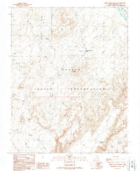
1989 Map of White Mesa Village
USGS Topo · Published 1989About this map
The Navajo Indian Reservation landscape in San Juan County is defined by a dense network of energy extraction infrastructure and traditional land names. By the late 1980s, the Aneth Field had become a complex industrial corridor, marked by a high concentration of Oil Wells, Gas Wells, and pipelines that cut across the arid terrain. These modern additions contrast with long-standing geographic markers like Flat Top Mountain and Tow Gray Hill.
Find a feature on this map
28 named features on this map. Tap any name to fly to it.
Don’t see what you’re looking for? This feature index may not catch every label — zoom into the map to look around manually.
Map Details
Editions of this 1989 White Mesa Village Map
This is the sole edition of this map. No revisions or reprints were ever made.
Other maps of this area

1886 · Abajo
USGS Topo · 1:250,000

1892 · Abajo
USGS Topo · 1:250,000

1893 · Abajo
USGS Topo · 1:250,000

1956 · Cortez
USGS Topo · 1:250,000

1958 · Cortez
USGS Topo · 1:250,000

1958 · Aneth 1 SW
USGS Topo · 1:24,000

1958 · Cajon Mesa
USGS Topo · 1:62,500

1959 · Cortez
USGS Topo · 1:250,000

1962 · Cortez
USGS Topo · 1:250,000

1962 · Montezuma Creek
USGS Topo · 1:62,500
Featured Places
- Shiprock Agency
- White Rock Curve Village, Shiprock Agency
- Red Lake Village, Shiprock Agency
- White Mesa Village, Shiprock Agency
- San Juan County, UT