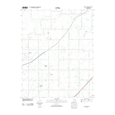
2010 Map of White Oak
USGS Topo · Published 2010About this map
Catale Oil Field stands as a primary marker of the industrial footprint in this area of Craig County, reflecting the region's historical reliance on mineral and oil extraction. The landscape is defined by a systematic grid of section-line roads, such as E 290 Rd and S 4320 Rd, which provide access to scattered homesteads and agricultural operations. Water management is a significant theme across the terrain, evidenced by several flood control structures including the Pryor Creek Watershed Site 27 Dam and the Pryor Creek Watershed Site 30 Dam. These efforts to harness the drainage of Pryor Creek and Little Pryor Creek underscore the ongoing efforts to stabilize the watershed for local farming. For genealogists, the map preserves the locations of the Shawnee Cemetery and White Oak Cemetery, anchoring family histories to the rural landscape.
Find a feature on this map
32 named features on this map. Tap any name to fly to it.
Don’t see what you’re looking for? This feature index may not catch every label — zoom into the map to look around manually.
Map Details
Editions of this 2010 White Oak Map
This is the sole edition of this map. No revisions or reprints were ever made.
Other maps of this area

1896 · Pryor
USGS Topo · 1:125,000

1901 · Vinita
USGS Topo · 1:125,000

1901 · Pryor
USGS Topo · 1:125,000

1913 · Vinita
USGS Topo · 1:125,000

1954 · Tulsa
USGS Topo · 1:250,000

1958 · Tulsa
USGS Topo · 1:250,000

1963 · Tulsa
USGS Topo · 1:250,000

1969 · Adair
USGS Topo · 1:24,000
1970 · Bushyhead
USGS Topo · 1:24,000

1970 · Chelsea
USGS Topo · 1:24,000