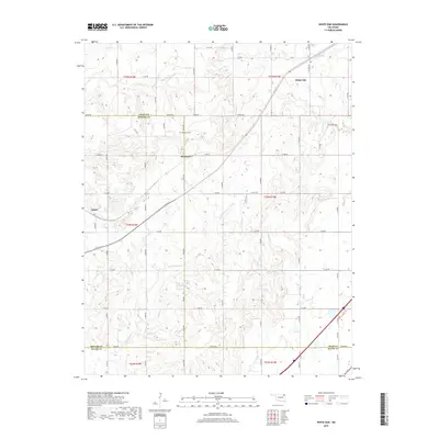
2019 Map of White Oak
USGS Topo · Published 2019About this map
White Oak and the surrounding prairie of northeastern Oklahoma are defined by a complex network of creeks and small-scale water management features in this 2019 survey. The terrain is bisected by numerous waterways including White Oak Cr, Little Pryor Cr, and Bitter Cr, which feed into the larger Pryor Cr system. This landscape reflects the rural character of the borderlands between Craig, Rogers, and Mayes Counties.
Find a feature on this map
37 named features on this map. Tap any name to fly to it.
Don’t see what you’re looking for? This feature index may not catch every label — zoom into the map to look around manually.
Map Details
Editions of this 2019 White Oak Map
This is the sole edition of this map. No revisions or reprints were ever made.
Other maps of this area

1896 · Pryor
USGS Topo · 1:125,000

1901 · Vinita
USGS Topo · 1:125,000

1901 · Pryor
USGS Topo · 1:125,000

1913 · Vinita
USGS Topo · 1:125,000

1954 · Tulsa
USGS Topo · 1:250,000

1958 · Tulsa
USGS Topo · 1:250,000

1963 · Tulsa
USGS Topo · 1:250,000

1969 · Adair
USGS Topo · 1:24,000
1970 · Bushyhead
USGS Topo · 1:24,000

1970 · Chelsea
USGS Topo · 1:24,000