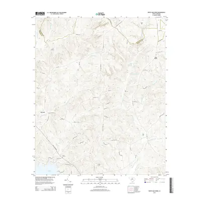
2014 Map of White Oak Creek
USGS Topo · Published 2014About this map
Flat Rock and Thorn Hill anchor this rural landscape along the border of Lancaster and Kershaw counties, where the Piedmont meets the upper coastal plain. The terrain is defined by a dense network of drainage, with White Oak Cr and Flat Rock Cr flowing toward the south, eventually reaching the northern reaches of Wateree Lake. For those tracing local families, the map is punctuated by numerous historical burial grounds including Beaver Creek Cem, Saint Johns Cem, White Oak Cem, and Smyries Cem.
Find a feature on this map
60 named features on this map. Tap any name to fly to it.
Don’t see what you’re looking for? This feature index may not catch every label — zoom into the map to look around manually.
Map Details
Editions of this 2014 White Oak Creek Map
This is the sole edition of this map. No revisions or reprints were ever made.
Other maps of this area

1935 · Camden
USGS Topo · 1:48,000

1938 · Camden
USGS Topo · 1:62,500

1941 · Spartanburg
USGS Topo · 1:250,000

1942 · Camden
USGS Topo · 1:125,000

1953 · Spartanburg
USGS Topo · 1:250,000

1960 · Spartanburg
USGS Topo · 1:250,000

1963 · Spartanburg
USGS Topo · 1:250,000

1964 · Spartanburg
USGS Topo · 1:250,000

1968 · Lancaster SE
USGS Topo · 1:24,000

1968 · Heath Springs
USGS Topo · 1:24,000