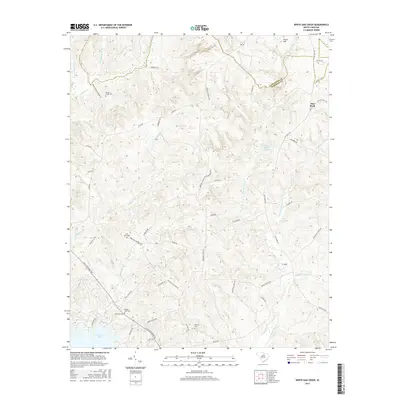
2017 Map of White Oak Creek
USGS Topo · Published 2017About this map
The boundary between Lancaster Co and Kershaw Co cuts through this landscape of creek drainages and high ground north of Wateree Lake. The settlement of Flat Rock serves as a focal point near the eastern edge, surrounded by family-named landmarks like Thorn Hill and Ft Hill. For those researching local lineages, the map identifies several burial grounds including Beaver Creek Cem, Saint Johns Cem, White Oak Cem, and Smyrles Cem. These cemeteries often signify the locations of early meeting houses or vanished community centers. The network of watercourses, such as White Oak Cr, Little Barfield Millpond, and Grannies Quarter Cr, illustrates the local topography that shaped road placements like Old Flat Rock Rd and John G Richards Rd.
Find a feature on this map
53 named features on this map. Tap any name to fly to it.
Don’t see what you’re looking for? This feature index may not catch every label — zoom into the map to look around manually.
Map Details
Editions of this 2017 White Oak Creek Map
This is the sole edition of this map. No revisions or reprints were ever made.
Other maps of this area

1935 · Camden
USGS Topo · 1:48,000

1938 · Camden
USGS Topo · 1:62,500

1941 · Spartanburg
USGS Topo · 1:250,000

1942 · Camden
USGS Topo · 1:125,000

1953 · Spartanburg
USGS Topo · 1:250,000

1960 · Spartanburg
USGS Topo · 1:250,000

1963 · Spartanburg
USGS Topo · 1:250,000

1964 · Spartanburg
USGS Topo · 1:250,000

1968 · Lancaster SE
USGS Topo · 1:24,000

1968 · Heath Springs
USGS Topo · 1:24,000