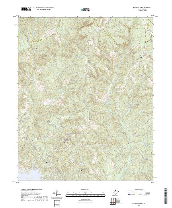
2024 Map of White Oak Creek
USGS Topo · Published 2024About this map
The boundary between Lancaster and Kershaw counties cuts through a landscape defined by rolling hills and small-scale church communities. Small rural settlements are anchored by historic meeting places like the Rock Springs United Methodist Church and the Ebenezer Church, many of which maintain adjacent burial grounds such as the White Oak Church Graveyard and Saint Johns Cem. The terrain rises toward local high points like Thorn Hill and Ft Hill, while the lower reaches of the quadrangle are dominated by the northern coves of Wateree Lake.
Find a feature on this map
58 named features on this map. Tap any name to fly to it.
Don’t see what you’re looking for? This feature index may not catch every label — zoom into the map to look around manually.
Map Details
Editions of this 2024 White Oak Creek Map
This is the sole edition of this map. No revisions or reprints were ever made.
Other maps of this area

1935 · Camden
USGS Topo · 1:48,000

1938 · Camden
USGS Topo · 1:62,500

1941 · Spartanburg
USGS Topo · 1:250,000

1942 · Camden
USGS Topo · 1:125,000

1953 · Spartanburg
USGS Topo · 1:250,000

1960 · Spartanburg
USGS Topo · 1:250,000

1963 · Spartanburg
USGS Topo · 1:250,000

1964 · Spartanburg
USGS Topo · 1:250,000

1968 · Lancaster SE
USGS Topo · 1:24,000

1968 · Heath Springs
USGS Topo · 1:24,000