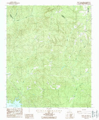
1988 Map of White Oak Creek
USGS Topo · Published 1988About this map
Wateree Lake dominates the southern reaches of this late 20th-century landscape, where the waters meet the complex drainage systems of Kershaw and Lancaster Counties. The terrain is defined by a dense network of tributaries including White Oak Creek, Grannies Quarter Creek, and the uniquely named Showerbath Creek. This provisional survey illustrates the rural character of the region during the late 1980s, highlighting the settlement at Flat Rock near the northern boundary. Industrial activity is indicated by a Quarry situated in the northeast, while prominent local topography is marked by Fort Hill. The map provides a detailed view of the natural watercourses such as Little Flat Rock Creek and Little Beaver Cr, which have historically shaped the agricultural and transport patterns of this Piedmont area near the county line.
Find a feature on this map
10 named features on this map. Tap any name to fly to it.
Don’t see what you’re looking for? This feature index may not catch every label — zoom into the map to look around manually.
Map Details
Editions of this 1988 White Oak Creek Map
This is the sole edition of this map. No revisions or reprints were ever made.
Other maps of this area

1935 · Camden
USGS Topo · 1:48,000

1938 · Camden
USGS Topo · 1:62,500

1941 · Spartanburg
USGS Topo · 1:250,000

1942 · Camden
USGS Topo · 1:125,000

1953 · Spartanburg
USGS Topo · 1:250,000

1960 · Spartanburg
USGS Topo · 1:250,000

1963 · Spartanburg
USGS Topo · 1:250,000

1964 · Spartanburg
USGS Topo · 1:250,000

1968 · Lancaster SE
USGS Topo · 1:24,000

1968 · Heath Springs
USGS Topo · 1:24,000