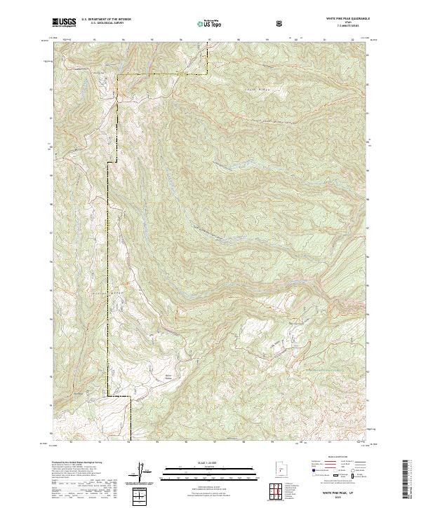
2023 Map of White Pine Peak
USGS Topo · Published 2023About this map
White Pine Peak rises as the central landmark of this high-elevation terrain within the Fishlake National Forest. The landscape is defined by the sharp transition across the Pahvant Range, where deeply incised drainages like North Fork Willow Creek Canyon and South Cedar Ridge Canyon carve through the limestone and volcanic geography. This modern survey illustrates the extensive recreational network that now defines the region, highlighting several segments of the Paiute (D-1) Trl and the historic Richfield-Pioneer route.
Find a feature on this map
36 named features on this map. Tap any name to fly to it.
Don’t see what you’re looking for? This feature index may not catch every label — zoom into the map to look around manually.
Map Details
Editions of this 2023 White Pine Peak Map
This is the sole edition of this map. No revisions or reprints were ever made.
Other maps of this area

1885 · Beaver
USGS Topo · 1:250,000

1932 · Sevier
USGS Topo · 1:62,500

1935 · Sevier
USGS Topo · 1:62,500

1940 · Monroe
USGS Topo · 1:62,500

1944 · Monroe
USGS Topo · 1:62,500

1953 · Richfield
USGS Topo · 1:250,000

1958 · Richfield
USGS Topo · 1:250,000

1961 · Fillmore
USGS Topo · 1:24,000

1961 · Mt. Catherine
USGS Topo · 1:24,000

1961 · Richfield
USGS Topo · 1:62,500