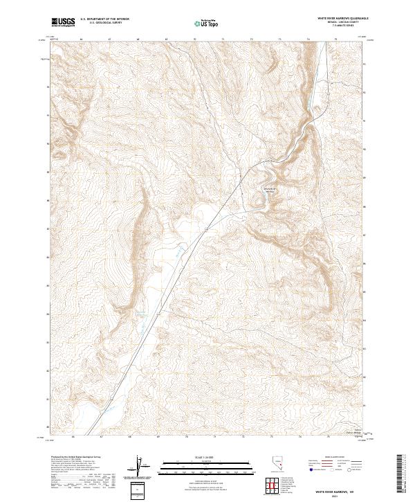
2021 Map of White River Narrows
USGS Topo · Published 2021About this map
White River Narrows provides a focal point for this high-desert landscape in Lincoln County, where the perennial White River carves through the arid terrain. The map details a critical water management site at Nesbitt Reservoir, located in the southern portion of the quadrangle. Highway 318 serves as the primary artery through this section of the Great Basin, tracing the river's path as it winds between the rising elevations of the Pahroc Range. This survey documents the modern layout of the Public Land Survey System, including t1s r61e and t1s r62e, illustrating how historical land divisions persist in the management of this remote Nevada corridor.
Find a feature on this map
9 named features on this map. Tap any name to fly to it.
Don’t see what you’re looking for? This feature index may not catch every label — zoom into the map to look around manually.
Map Details
Editions of this 2021 White River Narrows Map
This is the sole edition of this map. No revisions or reprints were ever made.
Other maps of this area

1885 · Pioche
USGS Topo · 1:250,000

1886 · Pioche
USGS Topo · 1:250,000

1954 · Caliente
USGS Topo · 1:250,000

1959 · Caliente
USGS Topo · 1:250,000

1970 · Hiko NE
USGS Topo · 1:24,000

1970 · Oreana Spring
USGS Topo · 1:24,000

1970 · Seaman Wash
USGS Topo · 1:24,000
1970 · Deadman Spring
USGS Topo · 1:24,000

1970 · Wheatgrass Spring
USGS Topo · 1:24,000

1970 · Fossil Peak
USGS Topo · 1:24,000