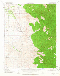
1952 Map of White River
USGS Topo · Published 1963About this map
The historical Stockton Los Angeles Stage Road anchors the western foothills of the Sierra Nevada, tracing a path through the ancient ranching country of southern Tulare County. This 1952 field-checked survey reveals a landscape defined by seasonal watercourses like Wagontail Creek and Grizzly Gulch that cut through the sharp rise of Tennessee Ridge and Cuidado Mtn. The eastern portion of the map is dominated by the steep, timbered slopes of the Tule River Indian Reservation, which rises toward Blue Mtn and its associated lookout.
Find a feature on this map
52 named features on this map. Tap any name to fly to it.
Don’t see what you’re looking for? This feature index may not catch every label — zoom into the map to look around manually.
Map Details
Editions of this 1952 White River Map
4 editions found
Other maps of this area

1904 · Kaweah
USGS Topo · 1:125,000

1909 · Kaweah
USGS Topo · 1:125,000

1920 · Delonagha
USGS Topo · 1:62,500

1926 · Quincy School
USGS Topo · 1:31,680

1926 · Glennville
USGS Topo · 1:62,500

1929 · Richgrove
USGS Topo · 1:31,680

1929 · Porterville
USGS Topo · 1:31,680

1929 · Quincy School
USGS Topo · 1:31,680

1929 · Ducor
USGS Topo · 1:31,680

1931 · Deepwell Ranch
USGS Topo · 1:31,680