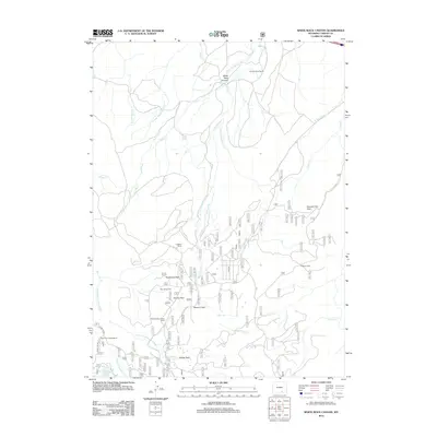
2012 Map of White Rock Canyon
USGS Topo · Published 2012About this map
Wick Brothers Ranch and the Wick Brothers Sheep Camp anchor the northern and southern portions of this Carbon County landscape, representing the enduring sheep ranching traditions of the Wyoming high country. The terrain is defined by the carved drainage of White Rock Canyon, where Wagonhound Cr and its numerous forks descend from the slopes of Conical Peak. Evidence of timber and recreation history is found throughout the central mountains, marked by a Logging Camp, Sawmill Park, and several high-altitude clearings including Racehorse Park and Stanley Park. To the southwest, the E Fork Medicine Bow River flows past the Bow River Campground near Long Lake, showing the area's transition into the Medicine Bow National Forest. This map captures a specialized mountain economy of seasonal camps and ranching outposts like Colberg Cabin.
Find a feature on this map
30 named features on this map. Tap any name to fly to it.
Don’t see what you’re looking for? This feature index may not catch every label — zoom into the map to look around manually.
Map Details
Editions of this 2012 White Rock Canyon Map
This is the sole edition of this map. No revisions or reprints were ever made.
Other maps of this area

1906 · Medicine Bow
USGS Topo · 1:125,000

1908 · Medicine Bow
USGS Topo · 1:125,000

1954 · Rawlins
USGS Topo · 1:250,000

1955 · Elk Mountain
USGS Topo · 1:24,000

1955 · Elk Mountain SW
USGS Topo · 1:24,000

1958 · Rawlins
USGS Topo · 1:250,000

1958 · White Rock Canyon
USGS Topo · 1:24,000

1958 · Arlington
USGS Topo · 1:24,000

1958 · Mc Fadden
USGS Topo · 1:24,000

1958 · T L Ranch
USGS Topo · 1:24,000