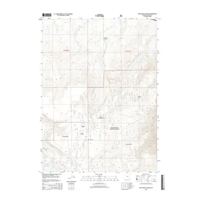
2015 Map of White Rock Canyon
USGS Topo · Published 2015About this map
The Medicine Bow National Forest dominates this landscape in the Medicine Bow Mountains, where the headwaters of several major drainages begin their descent. The terrain is defined by the deep incision of White Rock Canyon and prominent elevations such as Conical Peak. A series of high-altitude parks, including Stanley Park, Racehorse Park, and Willow Park, suggest the seasonal grazing and recreational patterns of this part of Carbon County. The hydrology is complex, with the Medicine Bow River and its E Fork Medicine Bow River carving through the south, while numerous creeks like Wagonhound Cr and Mule Cr flow through the northern reaches. The presence of Sawmill Park and Forest Rd 101 points to the area's history of timber management and forest access.
Find a feature on this map
27 named features on this map. Tap any name to fly to it.
Don’t see what you’re looking for? This feature index may not catch every label — zoom into the map to look around manually.
Map Details
Editions of this 2015 White Rock Canyon Map
This is the sole edition of this map. No revisions or reprints were ever made.
Other maps of this area

1906 · Medicine Bow
USGS Topo · 1:125,000

1908 · Medicine Bow
USGS Topo · 1:125,000

1954 · Rawlins
USGS Topo · 1:250,000

1955 · Elk Mountain
USGS Topo · 1:24,000

1955 · Elk Mountain SW
USGS Topo · 1:24,000

1958 · Rawlins
USGS Topo · 1:250,000

1958 · White Rock Canyon
USGS Topo · 1:24,000

1958 · Arlington
USGS Topo · 1:24,000

1958 · Mc Fadden
USGS Topo · 1:24,000

1958 · T L Ranch
USGS Topo · 1:24,000