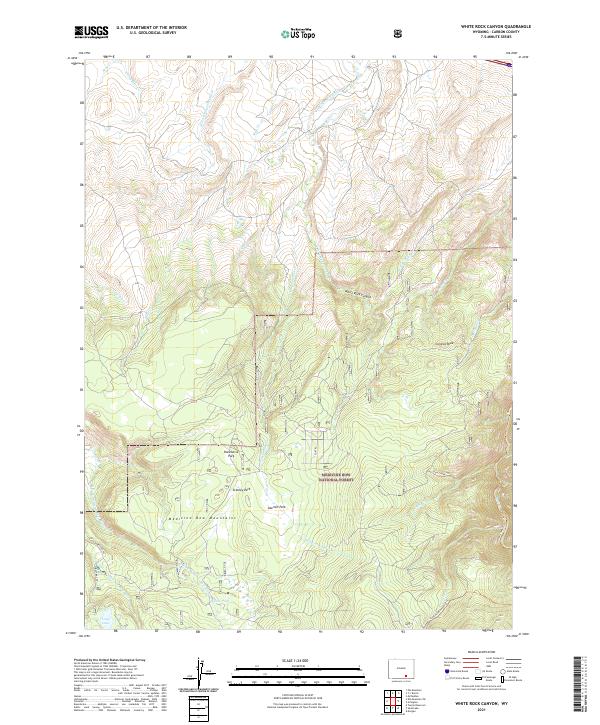
2021 Map of White Rock Canyon
USGS Topo · Published 2021About this map
The Medicine Bow National Forest dominates this section of Carbon County, where the high-altitude terrain of the Medicine Bow Mountains defines the landscape's hydrological and recreational character. Numerous high-country parks, including Racehorse Park, Stanley Park, and Sawmill Park, suggest a history of seasonal grazing and timber management within the forest boundaries. The drainage network is particularly intricate here, with the Medicine Bow River and its tributary, the E Fork Medicine Bow River, cutting through the southern reaches while White Rock Canyon marks a significant topographic feature to the north.
Find a feature on this map
34 named features on this map. Tap any name to fly to it.
Don’t see what you’re looking for? This feature index may not catch every label — zoom into the map to look around manually.
Map Details
Editions of this 2021 White Rock Canyon Map
This is the sole edition of this map. No revisions or reprints were ever made.
Other maps of this area

1906 · Medicine Bow
USGS Topo · 1:125,000

1908 · Medicine Bow
USGS Topo · 1:125,000

1954 · Rawlins
USGS Topo · 1:250,000

1955 · Elk Mountain
USGS Topo · 1:24,000

1955 · Elk Mountain SW
USGS Topo · 1:24,000

1958 · Rawlins
USGS Topo · 1:250,000

1958 · White Rock Canyon
USGS Topo · 1:24,000

1958 · Arlington
USGS Topo · 1:24,000

1958 · Mc Fadden
USGS Topo · 1:24,000

1958 · T L Ranch
USGS Topo · 1:24,000