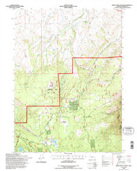
1992 Map of White Rock Canyon
USGS Topo · Published 1996About this map
Wick Brothers Ranch sits in the northern reaches of this high-elevation terrain, where the headwaters of numerous creeks begin their descent toward the lower plains. The landscape is defined by the sharp transition at the Medicine Bow National Forest Boundary, separating the open ranch lands from the densely wooded slopes and drainage basins of the Medicine Bow National Forest. In the southern portion of the quadrangle, the Medicine Bow River flows through a complex network of tributaries including Willow Creek and Brush Creek.
Find a feature on this map
28 named features on this map. Tap any name to fly to it.
Don’t see what you’re looking for? This feature index may not catch every label — zoom into the map to look around manually.
Map Details
Editions of this 1992 White Rock Canyon Map
This is the sole edition of this map. No revisions or reprints were ever made.
Other maps of this area

1906 · Medicine Bow
USGS Topo · 1:125,000

1908 · Medicine Bow
USGS Topo · 1:125,000

1954 · Rawlins
USGS Topo · 1:250,000

1955 · Elk Mountain
USGS Topo · 1:24,000

1955 · Elk Mountain SW
USGS Topo · 1:24,000

1958 · Rawlins
USGS Topo · 1:250,000

1958 · White Rock Canyon
USGS Topo · 1:24,000

1958 · Arlington
USGS Topo · 1:24,000

1958 · Mc Fadden
USGS Topo · 1:24,000

1958 · T L Ranch
USGS Topo · 1:24,000