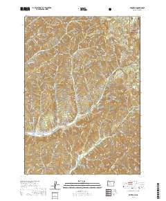
2020 Map of White Rock
USGS Topo · Published 2020About this map
Letitia Cem sits along S Myrtle Rd in this deeply dissected portion of the Southern Oregon Cascades. The landscape is defined by the high prominence of White Rock and Buck Butte, with the northeastern corner of the map extending into the Umpqua National Forest. This modern 2020 survey illustrates a complex network of forest management routes, including White Rock Rd and numerous BLM roads, that provide access to the timberlands and water sources like Briggs Reservoir. Drainage systems are densely carved throughout the terrain, with S Myrtle Cr and its tributaries like Lettia Cr flowing west, while Days Cr and Perdue Cr move toward the southeast. For those studying local history, the map preserves the location of Yellow Jacket Spring and the White Rock Trl, reflecting long-standing land use in these mountain drainages.
Find a feature on this map
92 named features on this map. Tap any name to fly to it.
Don’t see what you’re looking for? This feature index may not catch every label — zoom into the map to look around manually.
Map Details
Editions of this 2020 White Rock Map
This is the sole edition of this map. No revisions or reprints were ever made.
Other maps of this area

1891 · Ashland
USGS Topo · 1:250,000

1893 · Ashland
USGS Topo · 1:250,000

1897 · Roseburg
USGS Topo · 1:125,000

1897 · Ashland
USGS Topo · 1:250,000

1900 · Roseburg
USGS Topo · 1:125,000

1904 · Riddle
USGS Topo · 1:125,000

1944 · Tiller
USGS Topo · 1:62,500

1954 · Dixonville
USGS Topo · 1:62,500

1954 · Days Creek
USGS Topo · 1:62,500

1955 · Red Butte
USGS Topo · 1:62,500