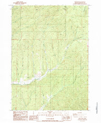
1987 Map of White Rock
USGS Topo · Published 1987About this map
North Myrtle Creek and South Myrtle Creek carve through the forested ridges of Douglas County in this provisional survey of the Umpqua National Forest. The landscape is defined by resource extraction and high-elevation water sources, featuring industrial landmarks like the Continental Mine and Overtain Mine, alongside several borrow pits and a Quarry. Local topography is anchored by prominent summits such as Riser Butte and Buck Butte, while the drainage network is supported by numerous named springs including White Rock Spring and Yellow Jacket Spring. A Weir located along the southern creek indicates managed water flow, characteristic of the era's focus on forest management and mineral exploration in this part of the Pacific Northwest.
Find a feature on this map
30 named features on this map. Tap any name to fly to it.
Don’t see what you’re looking for? This feature index may not catch every label — zoom into the map to look around manually.
Map Details
Editions of this 1987 White Rock Map
This is the sole edition of this map. No revisions or reprints were ever made.
Other maps of this area

1891 · Ashland
USGS Topo · 1:250,000

1893 · Ashland
USGS Topo · 1:250,000

1897 · Roseburg
USGS Topo · 1:125,000

1897 · Ashland
USGS Topo · 1:250,000

1900 · Roseburg
USGS Topo · 1:125,000

1904 · Riddle
USGS Topo · 1:125,000

1944 · Tiller
USGS Topo · 1:62,500

1954 · Dixonville
USGS Topo · 1:62,500

1954 · Days Creek
USGS Topo · 1:62,500

1955 · Red Butte
USGS Topo · 1:62,500