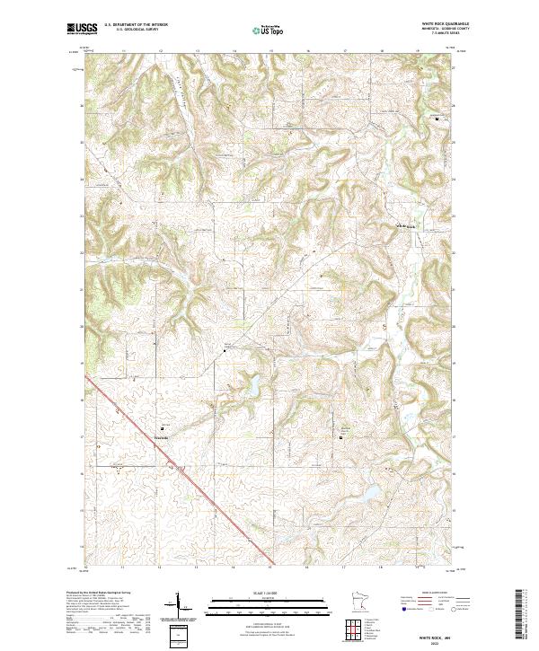
2022 Map of White Rock
USGS Topo · Published 2022About this map
White Rock and Wastedo anchor this rural Goodhue County landscape, where agriculture and early settlement patterns remain etched into the terrain. The topography is defined by the winding course of Belle Cr and the incision of Clark Valley, creating a network of ridges and hollows that historically dictated road placement and land use. For genealogists and local historians, the map is remarkably dense with burial sites, including the Episcopal Church Cem, Jempland Cem, and the centrally located Spring Garden Cem. Near the settlement of Wastedo, an Old Cem serves as a silent marker of the area's pioneer past. The road network, largely following section lines but occasionally deviating for the contours of Skunk Hollow Trl or Echo Valley Trl, illustrates the persistence of early township boundaries and transit corridors in this corner of Minnesota.
Find a feature on this map
63 named features on this map. Tap any name to fly to it.
Don’t see what you’re looking for? This feature index may not catch every label — zoom into the map to look around manually.
Map Details
Editions of this 2022 White Rock Map
This is the sole edition of this map. No revisions or reprints were ever made.
Other maps of this area

1944 · Red Wing
USGS Topo · 1:62,500

1952 · Red Wing
USGS Topo · 1:62,500

1953 · Saint Paul
USGS Topo · 1:250,000

1957 · Hastings
USGS Topo · 1:62,500

1959 · Saint Paul
USGS Topo · 1:250,000

1968 · Zumbrota
USGS Topo · 1:24,000

1968 · Kenyon
USGS Topo · 1:24,000

1968 · Sogn
USGS Topo · 1:24,000

1968 · Wanamingo
USGS Topo · 1:24,000

1968 · White Rock
USGS Topo · 1:24,000