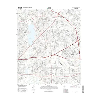
2016 Map of White Rock Lake
USGS Topo · Published 2016About this map
White Rock Lake serves as a central geographic anchor for this 2016 survey of eastern Dallas, where the city’s residential expansion meets the historical footprints of established neighborhoods and cemeteries. The landscape is defined by the winding course of White Rock Creek and its many tributaries, including Dixon Br and Beards Br, which cut through the dense street grid. This map captures a mature urban environment where major education and service centers like Eastfield Coll and the Dallas Institute of Funeral Service are situated amidst legacy areas like Reinhardt and Rawlins. Genealogists will find particular value in the documentation of the Cox Cem and the extensive grounds of Grove Hill Memorial Park, providing clear spatial context for these local heritage sites within the modern metropolitan sprawl of Garland and Mesquite.
Find a feature on this map
31 named features on this map. Tap any name to fly to it.
Don’t see what you’re looking for? This feature index may not catch every label — zoom into the map to look around manually.
Map Details
Editions of this 2016 White Rock Lake Map
This is the sole edition of this map. No revisions or reprints were ever made.
Other maps of this area

1891 · Dallas
USGS Topo · 1:125,000

1893 · Dallas
USGS Topo · 1:125,000

1931 · Carrollton
USGS Topo · 1:62,500

1954 · Dallas
USGS Topo · 1:250,000

1957 · White Rock Lake
USGS Topo · 1:24,000

1958 · Dallas
USGS Topo · 1:250,000

1958 · Hutchins
USGS Topo · 1:24,000

1958 · Oak Cliff
USGS Topo · 1:24,000

1958 · Dallas
USGS Topo · 1:24,000

1958 · White Rock Lake
USGS Topo · 1:24,000