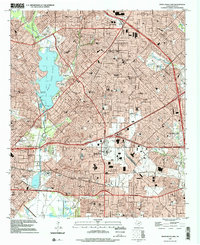
1995 Map of White Rock Lake
USGS Topo · Published 2002About this map
White Rock Lake serves as the central focal point for this survey of Northeast Dallas, where suburban expansion meets long-established landmarks. The map details the dense neighborhood networks of the mid-1990s, anchored by massive institutional grounds like the Buckner Baptist Childrens Home and Eastfield College. This area preserves traces of earlier settlements such as Reinhardt and Scyene, reflecting the transition from independent townships to the integrated urban fabric of the Dallas-Fort Worth metroplex.
Find a feature on this map
72 named features on this map. Tap any name to fly to it.
Don’t see what you’re looking for? This feature index may not catch every label — zoom into the map to look around manually.
Map Details
Editions of this 1995 White Rock Lake Map
This is the sole edition of this map. No revisions or reprints were ever made.
Other maps of this area

1891 · Dallas
USGS Topo · 1:125,000

1893 · Dallas
USGS Topo · 1:125,000

1931 · Carrollton
USGS Topo · 1:62,500

1954 · Dallas
USGS Topo · 1:250,000

1957 · White Rock Lake
USGS Topo · 1:24,000

1958 · Dallas
USGS Topo · 1:250,000

1958 · Hutchins
USGS Topo · 1:24,000

1958 · Oak Cliff
USGS Topo · 1:24,000

1958 · Dallas
USGS Topo · 1:24,000

1958 · White Rock Lake
USGS Topo · 1:24,000