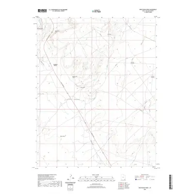
2020 Map of White Rock Point
USGS Topo · Published 2020About this map
San Juan Valley and its high desert terrain define this landscape within the Shiprock Agency region. The map documents a territory shaped by significant geological features, from the prominence of White Rock Point and Gray Point to the deep incisions of Window Rock Canyon and Ute Canyon. Water sources, critical in this arid environment, are marked at Window Rock Spring and Ute Spring, while the San Juan River and Gothic Cr provide the primary drainage. Transport and connectivity are centered on the arterial Mexican Water Rd and Indian Rte 5058, which link the scattered settlements of Tselakai Dezza and Casa del Eco Mesa. This modern survey details the road network extending across Nokaito Bench, illustrating the contemporary spatial organization of this high plateau country.
Find a feature on this map
26 named features on this map. Tap any name to fly to it.
Don’t see what you’re looking for? This feature index may not catch every label — zoom into the map to look around manually.
Map Details
Editions of this 2020 White Rock Point Map
This is the sole edition of this map. No revisions or reprints were ever made.
Other maps of this area

1886 · Abajo
USGS Topo · 1:250,000

1892 · Abajo
USGS Topo · 1:250,000

1893 · Abajo
USGS Topo · 1:250,000

1956 · Cortez
USGS Topo · 1:250,000

1958 · Cortez
USGS Topo · 1:250,000

1959 · Cortez
USGS Topo · 1:250,000

1962 · Cortez
USGS Topo · 1:250,000

1962 · Montezuma Creek
USGS Topo · 1:62,500

1962 · Bluff
USGS Topo · 1:62,500
1962 · Bluff SW
USGS Topo · 1:24,000