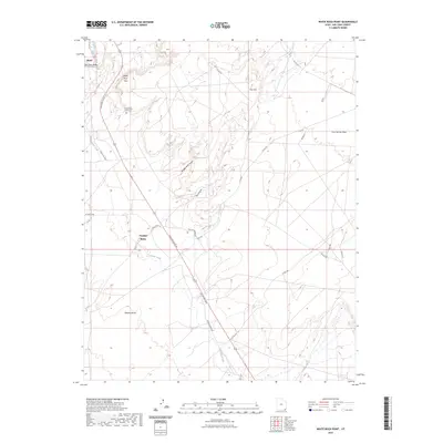
2023 Map of White Rock Point
USGS Topo · Published 2023About this map
Bluff sits at the northern edge of this high-desert landscape, where the San Juan River flows through the San Juan Valley. The terrain is defined by dramatic geological features, including the eponymous White Rock Point and the high elevations of Casa del Eco Mesa. Settlement is sparse, with the community of Tselakai Dezza appearing in the southern portion of the quadrangle along the Gothic Creek drainage. To the east of the primary settlements, the White Rock Point Cem serves as a significant landmark for genealogical research. Water sources are critical in this arid environment, evidenced by named locations like Window Rock Spring and Ute Spring. The map documents a network of county and Indian routes, such as Mexican Water Rd and Indian Rte 5058, which connect isolated benches like Nokaito Bench to the river valley.
Find a feature on this map
28 named features on this map. Tap any name to fly to it.
Don’t see what you’re looking for? This feature index may not catch every label — zoom into the map to look around manually.
Map Details
Editions of this 2023 White Rock Point Map
This is the sole edition of this map. No revisions or reprints were ever made.
Other maps of this area

1886 · Abajo
USGS Topo · 1:250,000

1892 · Abajo
USGS Topo · 1:250,000

1893 · Abajo
USGS Topo · 1:250,000

1956 · Cortez
USGS Topo · 1:250,000

1958 · Cortez
USGS Topo · 1:250,000

1959 · Cortez
USGS Topo · 1:250,000

1962 · Cortez
USGS Topo · 1:250,000

1962 · Montezuma Creek
USGS Topo · 1:62,500

1962 · Bluff
USGS Topo · 1:62,500
1962 · Bluff SW
USGS Topo · 1:24,000