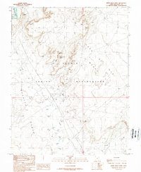
1989 Map of White Rock Point
USGS Topo · Published 1989About this map
Tohonadla Oil Field dominates the southern landscape of this 1989 survey, marked by a dense network of oil wells, Tanks, and a pipeline that reflects the industrial activity within the Navajo Indian Reservation. The terrain transitions from the high, flat expanse of Casa Del Mesa and Nokaito Bench into the deep incisions of Window Rock Canyon. To the north, the San Juan River cuts through the desert floor, while landmarks like White Rock Point and Natural Arch define the local topography.
Find a feature on this map
25 named features on this map. Tap any name to fly to it.
Don’t see what you’re looking for? This feature index may not catch every label — zoom into the map to look around manually.
Map Details
Editions of this 1989 White Rock Point Map
This is the sole edition of this map. No revisions or reprints were ever made.
Other maps of this area

1886 · Abajo
USGS Topo · 1:250,000

1892 · Abajo
USGS Topo · 1:250,000

1893 · Abajo
USGS Topo · 1:250,000

1956 · Cortez
USGS Topo · 1:250,000

1958 · Cortez
USGS Topo · 1:250,000

1959 · Cortez
USGS Topo · 1:250,000

1962 · Cortez
USGS Topo · 1:250,000

1962 · Montezuma Creek
USGS Topo · 1:62,500

1962 · Bluff
USGS Topo · 1:62,500
1962 · Bluff SW
USGS Topo · 1:24,000