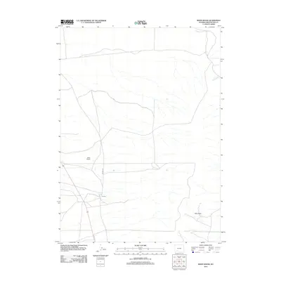
2012 Map of White Rocks
USGS Topo · Published 2012About this map
The Wells serves as a focal point in this high-desert landscape of Sweetwater County, where the infrastructure of the American West meets the physical terrain. The 2012 survey illustrates the path of Old Hwy 191 as it cuts across a region defined by the Sand Knolls and the drainage of Killpecker Cr. Unlike more densely populated areas, the map highlights the sparse nature of human presence, marked by only a few named locations such as White Rocks. This map is particularly useful for understanding modern land use and transportation corridors in southern Wyoming, showing how older routes like the former highway continue to define movement through these arid expanses.
Find a feature on this map
5 named features on this map. Tap any name to fly to it.
Don’t see what you’re looking for? This feature index may not catch every label — zoom into the map to look around manually.
Map Details
Editions of this 2012 White Rocks Map
This is the sole edition of this map. No revisions or reprints were ever made.
Other maps of this area

1954 · Rock Springs
USGS Topo · 1:250,000

1955 · Lander
USGS Topo · 1:250,000

1958 · Lander
USGS Topo · 1:250,000

1958 · Rock Springs
USGS Topo · 1:250,000

1958 · Essex Mountain
USGS Topo · 1:62,500

1958 · Boars Tusk
USGS Topo · 1:62,500

1961 · Lander
USGS Topo · 1:250,000

1962 · Rock Springs
USGS Topo · 1:250,000

1968 · Farson
USGS Topo · 1:24,000

1968 · Clay Buttes
USGS Topo · 1:24,000