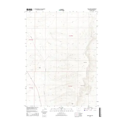
2015 Map of White Rocks
USGS Topo · Published 2015About this map
White Rocks defines the eastern terrain of this 2015 Sweetwater County survey, where the high arid plateau of White Mtn overlooks a landscape shaped by drainage draws and shifting sands. The historical transit corridor of Old Highway 191 cuts through the western sections, following a path that predates modern interstate developments. The map provides a detailed look at the hydrological features of the high desert, including the winding course of Killpecker Cr and several significant topographic depressions such as Stagecoach Draw and Sixmile Draw. To the south, the Sand Knolls highlight the region's active geomorphology. This survey is particularly useful for understanding the intersection of historical roadways and the natural obstacles of the Wyoming basin before any further infrastructure modifications.
Find a feature on this map
11 named features on this map. Tap any name to fly to it.
Don’t see what you’re looking for? This feature index may not catch every label — zoom into the map to look around manually.
Map Details
Editions of this 2015 White Rocks Map
This is the sole edition of this map. No revisions or reprints were ever made.
Other maps of this area

1954 · Rock Springs
USGS Topo · 1:250,000

1955 · Lander
USGS Topo · 1:250,000

1958 · Lander
USGS Topo · 1:250,000

1958 · Rock Springs
USGS Topo · 1:250,000

1958 · Essex Mountain
USGS Topo · 1:62,500

1958 · Boars Tusk
USGS Topo · 1:62,500

1961 · Lander
USGS Topo · 1:250,000

1962 · Rock Springs
USGS Topo · 1:250,000

1968 · Farson
USGS Topo · 1:24,000

1968 · Clay Buttes
USGS Topo · 1:24,000