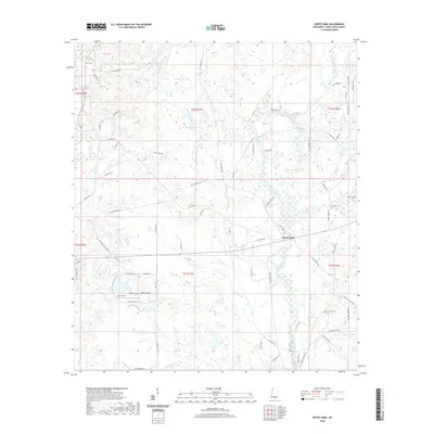
2020 Map of White Sand
USGS Topo · Published 2020About this map
White Sand serves as a central point in this rural Mississippi landscape, situated within a network of creek drainages that feed the West Hobolochitto Creek. The area is defined by its agricultural and residential development, evidenced by the clustered Oreck Farms and the residential layout at Enchanted Isle. Local transportation and utility are highlighted by the presence of Oreck Airport, accessed via Aviation Way, while historical footprints remain visible through family-named landmarks like Holdens Cem. Numerous small waterways, including Chinquapin Cr, Buckley Cr, and Turtle Creek, carve through the terrain, dictating the placement of rural roads like Buck Branch School Rd. This landscape reflects a contemporary Southern rural economy where family lands, small-scale aviation, and traditional cemeteries coexist alongside modern property tracts.
Find a feature on this map
84 named features on this map. Tap any name to fly to it.
Don’t see what you’re looking for? This feature index may not catch every label — zoom into the map to look around manually.
Map Details
Editions of this 2020 White Sand Map
This is the sole edition of this map. No revisions or reprints were ever made.
Other maps of this area

1942 · Pools Bluff
USGS Topo · 1:31,680

1949 · Bogalusa East
USGS Topo · 1:31,680

1949 · Angie
USGS Topo · 1:31,680

1953 · Mobile
USGS Topo · 1:250,000

1957 · Mobile
USGS Topo · 1:250,000

1958 · Picayune
USGS Topo · 1:62,500

1959 · Bogalusa
USGS Topo · 1:62,500

1959 · Poplarville
USGS Topo · 1:62,500

1960 · Mobile
USGS Topo · 1:250,000
1961 · Sun
USGS Topo · 1:62,500