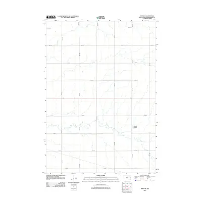
2012 Map of White SE
USGS Topo · Published 2012About this map
Medary Creek winds through the southern reaches of this Brookings County landscape, creating a meandering riparian corridor that breaks the strict geometric grid of the township's road system. Located in Alton Township, this area is characterized by the structured organization of South Dakota's agricultural heartland, where section lines are defined by long-reaching corridors like 214th St and 485th Ave. The settlement of Hillside Colony stands as a distinct communal landmark east of the creek's center, representing a localized hub within the otherwise dispersed rural setting. In the northern section of the map, the headwaters of Deer Creek carve similar, albeit smaller, paths across the plains. This 2012 survey illustrates the enduring relationship between the region's natural drainage patterns and the persistent surveyed boundaries of its farming communities.
Find a feature on this map
17 named features on this map. Tap any name to fly to it.
Don’t see what you’re looking for? This feature index may not catch every label — zoom into the map to look around manually.
Map Details
Editions of this 2012 White SE Map
This is the sole edition of this map. No revisions or reprints were ever made.
Other maps of this area

1953 · Watertown
USGS Topo · 1:250,000

1958 · Watertown
USGS Topo · 1:250,000

1964 · Flandreau NW
USGS Topo · 1:24,000

1964 · Aurora
USGS Topo · 1:24,000

1967 · Lake Benton NW
USGS Topo · 1:24,000

1967 · Lake Benton SW
USGS Topo · 1:24,000

1967 · Elkton
USGS Topo · 1:24,000

1970 · White NE
USGS Topo · 1:24,000

1970 · White
USGS Topo · 1:24,000

1972 · Flandreau NE
USGS Topo · 1:24,000
Featured Places
- Alton Township, SD
- Sherman Township, SD
- Newdale Hutterite Colony, SD
- Richland Township, SD
- Rolland Hutterite Colony, SD