
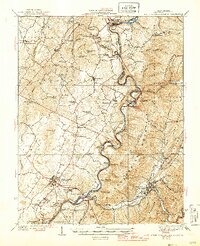
1939 Map of White Sulphur Springs
USGS Topo · Published 1939About this map
The Greenbrier River carves a winding path through the center of this 1930s survey, anchoring the cultural and economic life of the Greenbrier Valley. In the southwest, the intersection of U. S. Route No. 60 and 219 at Lewisburg serves as the regional hub, while the Chesapeake and Ohio RR follows the riverbanks through Caldwell and Whitcomb toward Ronceverte. The landscape is densely marked with early 20th-century rural infrastructure, featuring a notable concentration of small community schools such as Salomon Springs School, Pleasant View School, and Eccles School. Beyond the valley floor, the terrain rises into the Monongahela National Forest and onto prominent ridges like Kates Mountain and Coles Mountain. The presence of Camp Alleghany and numerous churches, including Walnut Grove Church and Enon Church, reflects a well-established social network within the distinct districts of Frankford and Falling Spring.
Find a feature on this map
98 named features on this map. Tap any name to fly to it.
Don’t see what you’re looking for? This feature index may not catch every label — zoom into the map to look around manually.
Map Details
Editions of this 1939 White Sulphur Springs Map
2 editions found
Other maps of this area

1887 · Hinton
USGS Topo · 1:125,000

1887 · Lewisburg
USGS Topo · 1:125,000

1889 · Nicholas
USGS Topo · 1:125,000

1891 · Lewisburg
USGS Topo · 1:125,000

1891 · Nicholas
USGS Topo · 1:125,000

1891 · Huntersville
USGS Topo · 1:125,000

1892 · Hinton
USGS Topo · 1:125,000

1894 · Huntersville
USGS Topo · 1:125,000

1901 · Nicholas
USGS Topo · 1:125,000

1918 · Richwood
USGS Topo · 1:62,500