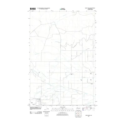
2011 Map of White Swan
USGS Topo · Published 2011About this map
White Swan serves as the primary hub of this landscape, situated at the edge of Medicine Valley and the broader Yakima Valley. The settlement pattern reflects a transition from the agricultural lowlands to the more open reaches of Olney Flat. An extensive network of irrigation infrastructure, including the West Unit One Highline Canal, Main Canal Extension, and the Ayres Lateral, demonstrates the managed water systems necessary for ranching and farming in this region.
Find a feature on this map
50 named features on this map. Tap any name to fly to it.
Don’t see what you’re looking for? This feature index may not catch every label — zoom into the map to look around manually.
Map Details
Editions of this 2011 White Swan Map
This is the sole edition of this map. No revisions or reprints were ever made.
Other maps of this area

1899 · Ellensburg
USGS Topo · 1:125,000

1901 · Ellensburg
USGS Topo · 1:125,000

1937 · White Swan
USGS Topo · 1:125,000

1950 · Yakima
USGS Topo · 1:250,000

1958 · Toppenish Mtn.
USGS Topo · 1:24,000

1958 · Harrah
USGS Topo · 1:24,000
1958 · Yakima West
USGS Topo · 1:24,000

1958 · Fort Simcoe
USGS Topo · 1:24,000

1958 · Fort Simcoe
USGS Topo · 1:62,500

1958 · Wiley City
USGS Topo · 1:24,000