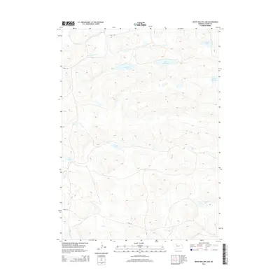
2014 Map of White Willow Lake
USGS Topo · Published 2014About this map
The North Loup River meanders across this northern section of the Nebraska Sandhills, a landscape defined more by its hydrologic network than by human settlement. This 2014 survey reveals an intricate cluster of lakes and basins, including the namesake White Willow Lake and Red Willow Lake, which sit at the heart of this sparsely populated region. The terrain is characterized by stabilized dunes that hold numerous wetlands, from the larger Jack Rabbit Lake and Little Alkali Lake to smaller isolated features like Tree Lake and Burr Lake. Human infrastructure is limited to a handful of unpaved thoroughfares such as Coble Rd and Phipps Rd, indicating a territory primarily dedicated to ranching and conservation. To the south, Calf Cr provides further drainage for this distinct prairie ecosystem, which remains one of the most intact grassland environments in the United States.
Find a feature on this map
12 named features on this map. Tap any name to fly to it.
Don’t see what you’re looking for? This feature index may not catch every label — zoom into the map to look around manually.
Map Details
Editions of this 2014 White Willow Lake Map
This is the sole edition of this map. No revisions or reprints were ever made.
Other maps of this area

1948 · Whitman
USGS Topo · 1:62,500

1949 · Steverson Lake
USGS Topo · 1:62,500

1950 · Whitman
USGS Topo · 1:62,500

1950 · Hire
USGS Topo · 1:62,500

1950 · Wolf Lake
USGS Topo · 1:62,500

1951 · Steverson Lake
USGS Topo · 1:62,500

1951 · Wolf Lake
USGS Topo · 1:62,500

1957 · Valentine
USGS Topo · 1:250,000

1959 · Valentine
USGS Topo · 1:250,000

1985 · Mullen
USGS Topo · 1:100,000