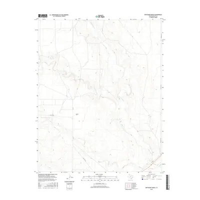
2016 Map of Whiteaker Ranch
USGS Topo · Published 2016About this map
Whiteaker Ranch serves as the namesake landmark for this portion of the Texas Panhandle, situated within a landscape defined by the drainage systems of the Canadian River basin. In this 2016 survey, the hydrology is dominated by the meandering paths of Punta de Agua Cr, Monica Cr, and Cramer Cr, which cut through the high plains terrain of Hartley County. The map details a network of rural transport including Bunker Hill Rd along the eastern boundary and Ranch Rd 3296, providing a clear view of contemporary ranching infrastructure and land management. This survey by the U.S. Geological Survey captures the sparse, open character of the region where cattle ranching remains the primary economic driver.
Find a feature on this map
7 named features on this map. Tap any name to fly to it.
Don’t see what you’re looking for? This feature index may not catch every label — zoom into the map to look around manually.
Map Details
Editions of this 2016 Whiteaker Ranch Map
This is the sole edition of this map. No revisions or reprints were ever made.
Other maps of this area

1954 · Tucumcari
USGS Topo · 1:250,000

1958 · Tucumcari
USGS Topo · 1:250,000

1971 · Koger Ranch
USGS Topo · 1:24,000

1971 · Middle Water
USGS Topo · 1:24,000

1971 · Doyle Hill
USGS Topo · 1:24,000

1971 · Amistad SE
USGS Topo · 1:24,000

1971 · Syndicate Hills
USGS Topo · 1:24,000

1971 · Beck Ranch
USGS Topo · 1:24,000

1971 · Whiteaker Ranch
USGS Topo · 1:24,000

1971 · Spring Creek Ranch
USGS Topo · 1:24,000