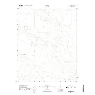
2019 Map of Whiteaker Ranch
USGS Topo · Published 2019About this map
Whiteaker Ranch anchors this high-plains landscape in Hartley County, a region defined by its expansive ranching heritage and the drainage patterns of the Texas Panhandle. The terrain is carved by the winding courses of Punta de Agua Cr, Monia Cr, and Cramer Cr, which reveal the underlying topography of the Llano Estacado. This 2019 survey illustrates the sparse, functional infrastructure of contemporary cattle country, where land use is dictated by water access and established property boundaries. Movement through the area relies on a thin network of rural thoroughfares, including Bunker Hill Rd, Ranch Rd 3296, and Co Rd 6, which connect the remote ranchstead to the broader county grid. For researchers, the map provides a clear record of modern land ownership patterns and the natural hydrography that has shaped settlement here for generations.
Find a feature on this map
7 named features on this map. Tap any name to fly to it.
Don’t see what you’re looking for? This feature index may not catch every label — zoom into the map to look around manually.
Map Details
Editions of this 2019 Whiteaker Ranch Map
This is the sole edition of this map. No revisions or reprints were ever made.
Other maps of this area

1954 · Tucumcari
USGS Topo · 1:250,000

1958 · Tucumcari
USGS Topo · 1:250,000

1971 · Koger Ranch
USGS Topo · 1:24,000

1971 · Middle Water
USGS Topo · 1:24,000

1971 · Doyle Hill
USGS Topo · 1:24,000

1971 · Amistad SE
USGS Topo · 1:24,000

1971 · Syndicate Hills
USGS Topo · 1:24,000

1971 · Beck Ranch
USGS Topo · 1:24,000

1971 · Whiteaker Ranch
USGS Topo · 1:24,000

1971 · Spring Creek Ranch
USGS Topo · 1:24,000