
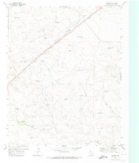
1971 Map of Whiteaker Ranch
USGS Topo · Published 1973About this map
Whiteaker Ranch and its surrounding rangeland define this section of the Texas Panhandle in the early 1970s. The landscape is deeply incised by the drainage systems of Monia Creek, Cramer Creek, and the winding Punta de Agua Creek, which carve through the high plains terrain. Land use is oriented toward large-scale ranching and industrial utility, evidenced by a network of named water sources like Little Sandy Well, Thousand Acre Well, and Northeast Park Hill Well that sustain livestock across the arid expanses.
Find a feature on this map
16 named features on this map. Tap any name to fly to it.
Don’t see what you’re looking for? This feature index may not catch every label — zoom into the map to look around manually.
Map Details
Editions of this 1971 Whiteaker Ranch Map
This is the sole edition of this map. No revisions or reprints were ever made.
Other maps of this area

1954 · Tucumcari
USGS Topo · 1:250,000

1958 · Tucumcari
USGS Topo · 1:250,000

1971 · Koger Ranch
USGS Topo · 1:24,000

1971 · Middle Water
USGS Topo · 1:24,000

1971 · Doyle Hill
USGS Topo · 1:24,000

1971 · Amistad SE
USGS Topo · 1:24,000

1971 · Syndicate Hills
USGS Topo · 1:24,000

1971 · Beck Ranch
USGS Topo · 1:24,000

1971 · Spring Creek Ranch
USGS Topo · 1:24,000
1971 · Romero
USGS Topo · 1:24,000