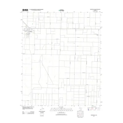
2012 Map of Whiteface
USGS Topo · Published 2012About this map
Whiteface sits at the junction of Fm-1780 and Fm-769 in this high plains region of West Texas. The grid-like layout of the settlement, with streets such as N Fillmore St, Arthur St, and Payne St, illustrates the organized expansion typical of the Llano Estacado. Moving east across the landscape, the rural character is defined by long, straight thoroughfares like America Rd and Houston St, connecting to the smaller community of Coble along Fm-303. The presence of labels like Wildcat Rd and Transport Rd reflects the importance of the local industry and utility infrastructure. This 2012 survey captures the transition of the South Plains, where wide-open agricultural expanses meet the concentrated residential blocks of small Panhandle towns.
Find a feature on this map
43 named features on this map. Tap any name to fly to it.
Don’t see what you’re looking for? This feature index may not catch every label — zoom into the map to look around manually.
Map Details
Editions of this 2012 Whiteface Map
This is the sole edition of this map. No revisions or reprints were ever made.
Other maps of this area

1954 · Brownfield
USGS Topo · 1:250,000

1958 · Brownfield
USGS Topo · 1:250,000

1962 · Brownfield
USGS Topo · 1:250,000

1965 · Levelland West
USGS Topo · 1:24,000

1965 · Sundown
USGS Topo · 1:24,000

1965 · Plains 1 NE
USGS Topo · 1:24,000

1965 · Hester Ranch
USGS Topo · 1:24,000

1965 · Pettit
USGS Topo · 1:24,000

1965 · Whiteface
USGS Topo · 1:24,000

1970 · Whiteface SW
USGS Topo · 1:24,000