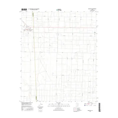
2016 Map of Whiteface
USGS Topo · Published 2016About this map
Whiteface sits at the intersection of State Highway 114 and FM 1780 in this portion of the Texas Panhandle during the mid-2010s. The town's grid is clearly defined by local streets such as Arthur St, N Tyler St, and W 2nd St, with the Whiteface Cem located on the western edge. This map documents a landscape heavily influenced by the Rectangular Survey System, where long, straight roads like America Rd and Santa Fe Rd segment the territory into massive agricultural or industrial blocks. The ephemeral drainage of Lost Draw meanders across the southern half of the quadrangle, cutting through the geometric road network that includes locally named routes like Ventine and Calico. Further east, the settlement of Coble marks another point of human activity along the Cochran-Hockley county line.
Find a feature on this map
41 named features on this map. Tap any name to fly to it.
Don’t see what you’re looking for? This feature index may not catch every label — zoom into the map to look around manually.
Map Details
Editions of this 2016 Whiteface Map
This is the sole edition of this map. No revisions or reprints were ever made.
Other maps of this area

1954 · Brownfield
USGS Topo · 1:250,000

1958 · Brownfield
USGS Topo · 1:250,000

1962 · Brownfield
USGS Topo · 1:250,000

1965 · Levelland West
USGS Topo · 1:24,000

1965 · Sundown
USGS Topo · 1:24,000

1965 · Plains 1 NE
USGS Topo · 1:24,000

1965 · Hester Ranch
USGS Topo · 1:24,000

1965 · Pettit
USGS Topo · 1:24,000

1965 · Whiteface
USGS Topo · 1:24,000

1970 · Whiteface SW
USGS Topo · 1:24,000