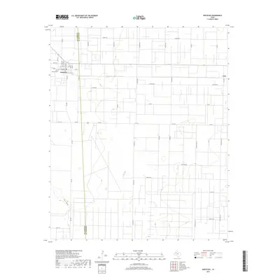
2019 Map of Whiteface
USGS Topo · Published 2019About this map
Whiteface sits at the western edge of this 2019 survey, where the grid of the Llano Estacado meets the municipal street plan. The town is structured around a central grid including Polk St, Pierce St, and Hayes St, while the surrounding landscape is defined by extensive section roads and the shallow depression of Lost Draw meandering through the southern reaches. This era shows the developed network of agricultural and ranching infrastructure, punctuated by family-named routes like Sampson Post Rd and Richmond Rd. Near the town site, Whiteface Cem serves as a primary genealogical landmark. The eastern boundary is marked by the small settlement of Coble and the county line between Cochran and Hockley counties, illustrating the rural connectivity and spatial organization of the Texas High Plains during the early twenty-first century.
Find a feature on this map
41 named features on this map. Tap any name to fly to it.
Don’t see what you’re looking for? This feature index may not catch every label — zoom into the map to look around manually.
Map Details
Editions of this 2019 Whiteface Map
This is the sole edition of this map. No revisions or reprints were ever made.
Other maps of this area

1954 · Brownfield
USGS Topo · 1:250,000

1958 · Brownfield
USGS Topo · 1:250,000

1962 · Brownfield
USGS Topo · 1:250,000

1965 · Levelland West
USGS Topo · 1:24,000

1965 · Sundown
USGS Topo · 1:24,000

1965 · Plains 1 NE
USGS Topo · 1:24,000

1965 · Hester Ranch
USGS Topo · 1:24,000

1965 · Pettit
USGS Topo · 1:24,000

1965 · Whiteface
USGS Topo · 1:24,000

1970 · Whiteface SW
USGS Topo · 1:24,000