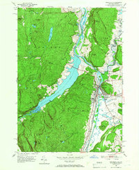
1950 Map of Whitehall
USGS Topo · Published 1966About this map
Whitehall serves as a pivotal point on this 1950 survey, where the Mettawee River and the northern reach of Lake Champlain meet the Delaware and Hudson railroad lines. This corridor was historically significant as a transportation nexus between New York and Vermont, reflected in the density of infrastructure surrounding the town center. The map details the transition from the industrial and rail-heavy environment of the valley to the elevated wilderness of Adirondack State Park to the west, marked by prominent heights like Whitehall Mountain and Skene Mtn.
Find a feature on this map
57 named features on this map. Tap any name to fly to it.
Don’t see what you’re looking for? This feature index may not catch every label — zoom into the map to look around manually.
Map Details
Editions of this 1950 Whitehall Map
4 editions found
Other maps of this area

1893 · Fort Ann
USGS Topo · 1:62,500

1893 · Whitehall
USGS Topo · 1:62,500

1895 · Whitehall
USGS Topo · 1:62,500

1895 · Fort Ann
USGS Topo · 1:62,500

1895 · Glens Falls
USGS Topo · 1:62,500

1897 · Bolton
USGS Topo · 1:62,500

1897 · Glens Falls
USGS Topo · 1:62,500

1898 · Whitehall
USGS Topo · 1:62,500

1898 · Fort Ann
USGS Topo · 1:62,500

1900 · Bolton
USGS Topo · 1:62,500