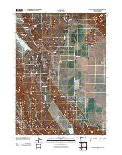
2011 Map of Whiteline Reservoir
USGS Topo · Published 2011About this map
Janssen Ranch, Edgewood Ranch, and Coleman Ranch anchor a landscape defined by livestock operations and water management in this 2011 survey of Klamath County. The terrain transitions from the high ground of Twomile Ridge and Grizzly Butte down into productive valleys such as Antelope Valley and Meadow Lake Valley. This era's infrastructure is dominated by water sources critical to the high desert, including Whiteline Reservoir and the Meadow Lake Dam at Meadow Lake. For genealogists and local historians, the map preserves the locations of the Gabriel Cemetery and Hibbert Cemetery, alongside several named springs like Chitwood Spring and Brookside Spring that likely served as early settlement nodes. The presence of the Oreteck Post Office in the southwest corner marks a specific hub of commerce and communication for this rural community.
Find a feature on this map
36 named features on this map. Tap any name to fly to it.
Don’t see what you’re looking for? This feature index may not catch every label — zoom into the map to look around manually.
Map Details
Editions of this 2011 Whiteline Reservoir Map
This is the sole edition of this map. No revisions or reprints were ever made.
Other maps of this area

1889 · Klamath
USGS Topo · 1:250,000

1894 · Klamath
USGS Topo · 1:250,000

1955 · Klamath Falls
USGS Topo · 1:250,000

1957 · Merrill
USGS Topo · 1:62,500

1957 · Swan Lake
USGS Topo · 1:62,500

1957 · Klamath Falls
USGS Topo · 1:62,500

1957 · Modoc Point
USGS Topo · 1:62,500

1958 · Klamath Falls
USGS Topo · 1:250,000
1975 · Klamath Falls NE
USGS Topo · 1:24,000

1975 · Merrill NW
USGS Topo · 1:24,000