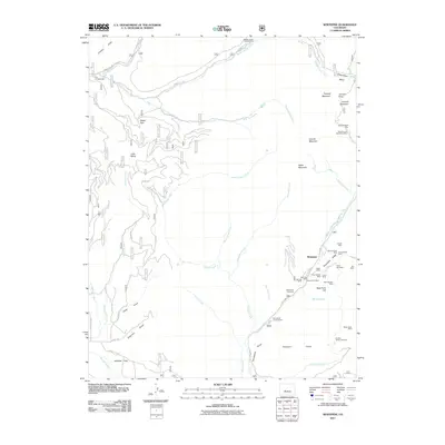
2011 Map of Whitepine
USGS Topo · Published 2011About this map
Whitepine stands at the center of an intensive high-altitude mining district in the Gunnison County mountains. This 2011 survey details a landscape where industrial history and modern recreation intersect along the banks of Tomichi Creek. The eastern portion of the map is densely clustered with historical mining claims, including the Akron Mine, Tomichi Mine, and the David H Shaft Mine near Porcupine Ridge. This concentration of tunnels and shafts, such as the Ensign Tunnel Mine, points to the region's silver and lead heritage.
Find a feature on this map
58 named features on this map. Tap any name to fly to it.
Don’t see what you’re looking for? This feature index may not catch every label — zoom into the map to look around manually.
Map Details
Editions of this 2011 Whitepine Map
This is the sole edition of this map. No revisions or reprints were ever made.
Other maps of this area

1940 · Garfield
USGS Topo · 1:62,500

1941 · Pitkin
USGS Topo · 1:62,500

1945 · Pitkin
USGS Topo · 1:62,500

1945 · Garfield
USGS Topo · 1:62,500

1956 · Montrose
USGS Topo · 1:250,000

1959 · Montrose
USGS Topo · 1:250,000

1960 · Montrose
USGS Topo · 1:250,000

1962 · Doyleville
USGS Topo · 1:24,000
1964 · Pitkin
USGS Topo · 1:24,000

1964 · Sargents
USGS Topo · 1:24,000