
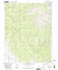
1982 Map of Whitepine
USGS Topo · Published 1983About this map
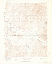
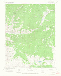
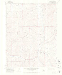
Whitepine stands as a focal point of high-altitude mining activity in the Sawatch Range, where the settlement is surrounded by an extensive network of mineral claims and extraction sites. This 1982 survey documents a landscape defined by its industrial history, prominently featuring the Akron Mine and North Star Mine near Porcupine Creek. The eastern boundary follows the rugged divide between Gunnison and Chaffee counties, cutting through the summits of Granite Mountain and Stella Mountain.
Find a feature on this map
54 named features on this map. Tap any name to fly to it.
Don’t see what you’re looking for? This feature index may not catch every label — zoom into the map to look around manually.
Map Details
Editions of this 1982 Whitepine Map
2 editions found
Other maps of this area

1940 · Garfield
USGS Topo · 1:62,500
1941 · Pitkin
USGS Topo · 1:62,500
1945 · Pitkin
USGS Topo · 1:62,500
1945 · Garfield
USGS Topo · 1:62,500

1956 · Montrose
USGS Topo · 1:250,000

1959 · Montrose
USGS Topo · 1:250,000

1960 · Montrose
USGS Topo · 1:250,000
1962 · Doyleville
USGS Topo · 1:24,000
1964 · Pitkin
USGS Topo · 1:24,000
1964 · Sargents
USGS Topo · 1:24,000