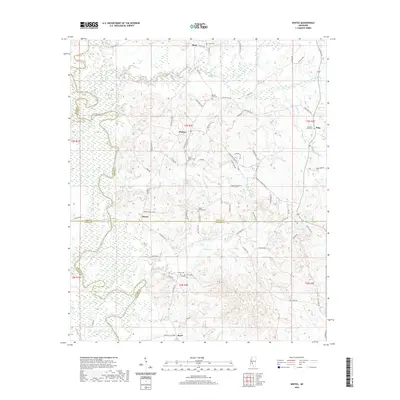
2020 Map of Whites
USGS Topo · Published 2020About this map
Steen Creek and Mountain Cr carve through the landscape of central Mississippi where Hinds Co, Rankin Co, Copiah Co, and Simpson Co meet. This area, largely defined by its rural settlements like Whites and Alonzo, reflects a community deeply tied to its local history through a series of family and community burial grounds. These include the Sinai Cem in the north and Antioch Cem near the southern border, providing vital markers for genealogical research in this multi-county region. The Pearl River snakes along the southwestern edge of the quadrangle, serving as a natural boundary while drainage systems like Rocky Cr and Bear Cr feed into the broader basin. This 2020 survey documents the persisting rural character of the region, where older road systems like Old Enochs Rd and Stamps Quarters still define local movement across the county lines.
Find a feature on this map
78 named features on this map. Tap any name to fly to it.
Don’t see what you’re looking for? This feature index may not catch every label — zoom into the map to look around manually.
Map Details
Editions of this 2020 Whites Map
This is the sole edition of this map. No revisions or reprints were ever made.
Other maps of this area

1903 · Jackson
USGS Topo · 1:125,000

1906 · Florence
USGS Topo · 1:62,500

1908 · Florence
USGS Topo · 1:62,500

1937 · Terry
USGS Topo · 1:48,000

1943 · Terry
USGS Topo · 1:62,500

1953 · Natchez
USGS Topo · 1:250,000

1955 · Jackson
USGS Topo · 1:250,000

1956 · Natchez
USGS Topo · 1:250,000

1959 · Natchez
USGS Topo · 1:250,000

1961 · Jackson
USGS Topo · 1:250,000