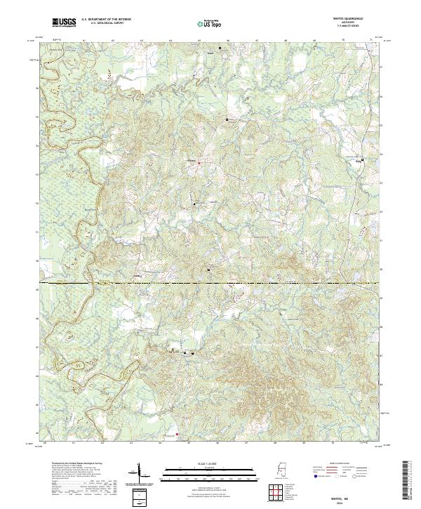
2024 Map of Whites
USGS Topo · Published 2024About this map
The Pearl River winds through the western reaches of this area, defining the border between Hinds and Rankin counties. This modern landscape is characterized by a network of rural settlements including Whites, Sinai, and Alonzo, where numerous family and community burial grounds serve as anchors for local history. Cemeteries such as Antioch Cem and Clear Branch Cem are scattered across the terrain, often located near the headwaters of local drainages like Steen Creek and Bear Creek.
Find a feature on this map
91 named features on this map. Tap any name to fly to it.
Don’t see what you’re looking for? This feature index may not catch every label — zoom into the map to look around manually.
Map Details
Editions of this 2024 Whites Map
This is the sole edition of this map. No revisions or reprints were ever made.
Other maps of this area

1903 · Jackson
USGS Topo · 1:125,000

1906 · Florence
USGS Topo · 1:62,500

1908 · Florence
USGS Topo · 1:62,500

1937 · Terry
USGS Topo · 1:48,000

1943 · Terry
USGS Topo · 1:62,500

1953 · Natchez
USGS Topo · 1:250,000

1955 · Jackson
USGS Topo · 1:250,000

1956 · Natchez
USGS Topo · 1:250,000

1959 · Natchez
USGS Topo · 1:250,000

1961 · Jackson
USGS Topo · 1:250,000