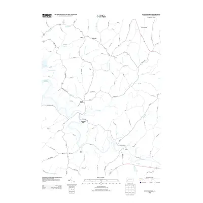
2013 Map of Whitesburg
USGS Topo · Published 2013About this map
Cochrans Mills and Brick Church anchor a landscape defined by the winding waters of Crooked Cr and the northern reaches of Crooked Creek Lake. This 2013 survey reveals the rural character of Armstrong County, where small crossroads settlements like Shay, Girty, and Mateer persist along a network of historic local roads. The terrain is deeply carved by numerous runs, including Cherry Run, Pine Run, and Campbell Run, illustrating the drainage patterns that have shaped the region's agricultural and social layout for generations. While larger routes like Us-422 clip the corner near Whitesburg, the majority of the map focuses on the interior valleys where family-named landmarks like Baker Hollow and the obscure locality of Pyrra speak to the area's deep-rooted local history and genealogy.
Find a feature on this map
104 named features on this map. Tap any name to fly to it.
Don’t see what you’re looking for? This feature index may not catch every label — zoom into the map to look around manually.
Map Details
Editions of this 2013 Whitesburg Map
This is the sole edition of this map. No revisions or reprints were ever made.
Other maps of this area

1900 · Kittanning
USGS Topo · 1:62,500

1901 · Rural Valley
USGS Topo · 1:62,500

1902 · Kittanning
USGS Topo · 1:62,500

1902 · Elders Ridge
USGS Topo · 1:62,500

1903 · Rural Valley
USGS Topo · 1:62,500

1904 · Elders Ridge
USGS Topo · 1:62,500

1907 · Freeport
USGS Topo · 1:62,500

1909 · Freeport
USGS Topo · 1:62,500

1953 · Pittsburgh
USGS Topo · 1:250,000
1953 · Vandergrift
USGS Topo · 1:24,000