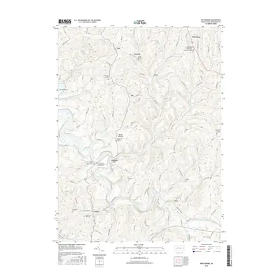
2016 Map of Whitesburg
USGS Topo · Published 2016About this map
Cochrans Mills and Brick Church serve as central community hubs in this rural stretch of Armstrong County, where the landscape is defined by the winding waters of Crooked Creek and its many tributaries. The area is dense with legacy sites for genealogists, featuring numerous denominational landmarks like Saint Michaels Lutheran Church and the Whitesburg Presbyterian Church. A high concentration of family-named burial grounds, including McDonalds Cem, Rupert Cem, and Shellhammer Beck Cem, suggests deep-rooted ancestral ties across the small settlements of Girty, Shay, and Mateer. The presence of Crooked Cr Lake and various runs like Cherry Run and Fagley Run illustrate a terrain deeply etched by water, dictating the placement of historic farmsteads and rural roads throughout South Bend Township.
Find a feature on this map
109 named features on this map. Tap any name to fly to it.
Don’t see what you’re looking for? This feature index may not catch every label — zoom into the map to look around manually.
Map Details
Editions of this 2016 Whitesburg Map
This is the sole edition of this map. No revisions or reprints were ever made.
Other maps of this area

1900 · Kittanning
USGS Topo · 1:62,500

1901 · Rural Valley
USGS Topo · 1:62,500

1902 · Kittanning
USGS Topo · 1:62,500

1902 · Elders Ridge
USGS Topo · 1:62,500

1903 · Rural Valley
USGS Topo · 1:62,500

1904 · Elders Ridge
USGS Topo · 1:62,500

1907 · Freeport
USGS Topo · 1:62,500

1909 · Freeport
USGS Topo · 1:62,500

1953 · Pittsburgh
USGS Topo · 1:250,000
1953 · Vandergrift
USGS Topo · 1:24,000