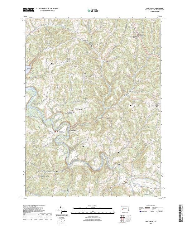
2023 Map of Whitesburg
USGS Topo · Published 2023About this map
Cochrans Mills and the nearby Brick Church anchor this section of Armstrong County, where the topography is defined by the winding course of Crooked Creek. The map reveals a deeply rooted rural landscape, characterized by numerous small family and church-affiliated burial grounds such as the Ramaley Family Cem and the Shellhammer - Beck Cem. These sites, along with settlements like Girty, Shay, and Whitesburg, illustrate the dispersed settlement pattern typical of western Pennsylvania's plateau country.
Find a feature on this map
109 named features on this map. Tap any name to fly to it.
Don’t see what you’re looking for? This feature index may not catch every label — zoom into the map to look around manually.
Map Details
Editions of this 2023 Whitesburg Map
This is the sole edition of this map. No revisions or reprints were ever made.
Other maps of this area

1900 · Kittanning
USGS Topo · 1:62,500

1901 · Rural Valley
USGS Topo · 1:62,500

1902 · Kittanning
USGS Topo · 1:62,500

1902 · Elders Ridge
USGS Topo · 1:62,500

1903 · Rural Valley
USGS Topo · 1:62,500

1904 · Elders Ridge
USGS Topo · 1:62,500

1907 · Freeport
USGS Topo · 1:62,500

1909 · Freeport
USGS Topo · 1:62,500

1953 · Pittsburgh
USGS Topo · 1:250,000
1953 · Vandergrift
USGS Topo · 1:24,000
Featured Places
- South Bend Township, PA
- Burrell Township, PA
- Parks Township, PA
- Bethel Township, PA
- Plumcreek Township, PA